implementation of all stages of engineering geological survey
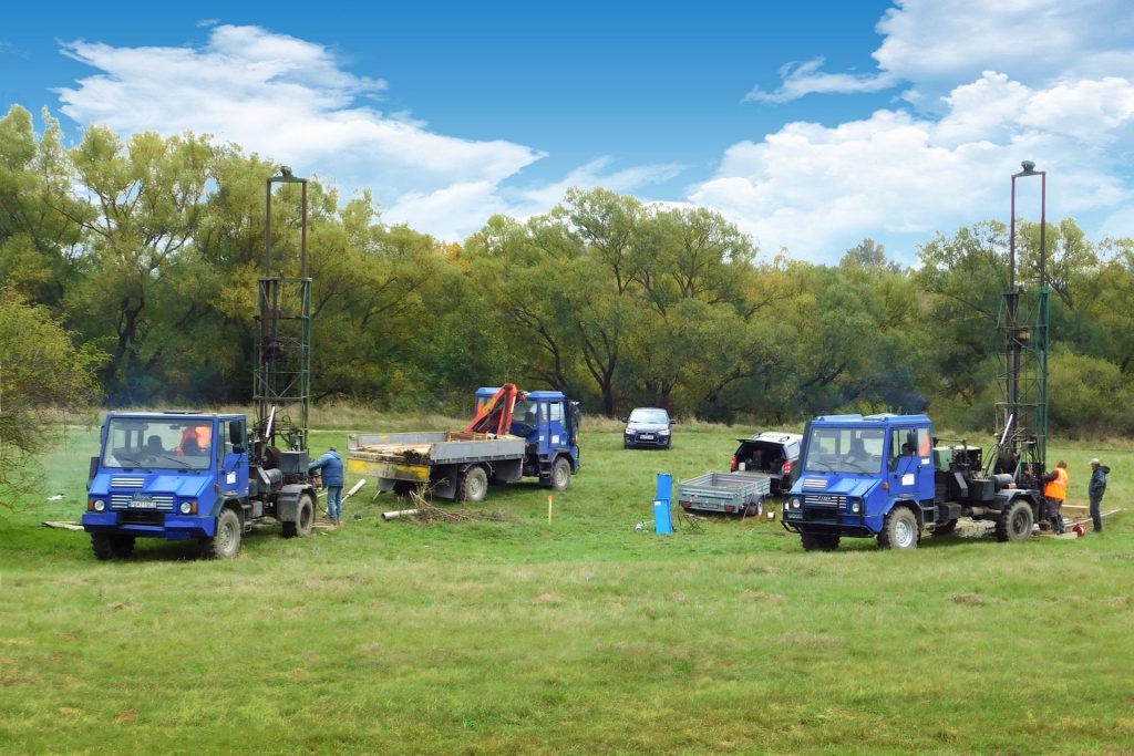
design, implementation and evaluation of exploration work, including drilling work
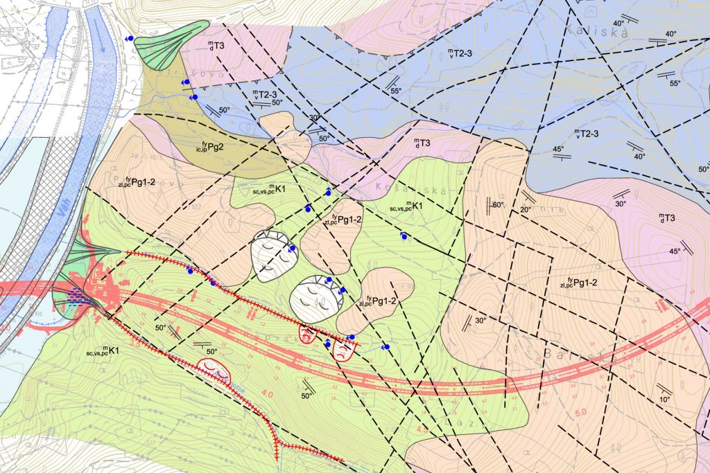
engineering geological mapping and compilation of engineering geological maps
construction of longitudinal profiles and cross sections
evaluation of engineering geological conditions, description and classification of individual soils and rocks in terms of applicable standards, evaluation of soil bearing capacity
identification of engineering geological risks, recommendations for the foundation of buildings
processing the use of excavated soils and rocks with the design of landfills of unsuitable material in accordance with applicable legislation
recommendation of sites for obtaining building material examination of soil characteristics in terms of suitability for use in embankments
field tests and measurements of soil and rock properties on the surface, in underground and in boreholes
HYDROGEOLOGY
implementation of all stages of hydrogeological survey
hydrogeological mapping, compilation of hydrogeological maps
implementation and evaluation of pumping and infiltration tests
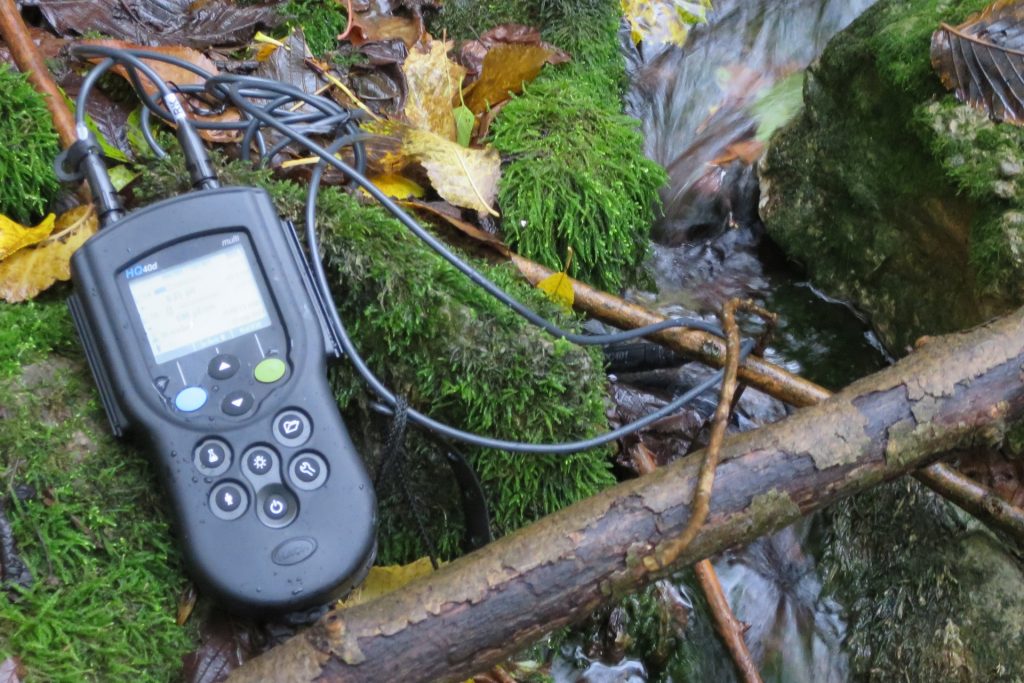
passportization of wells and water sources regime groundwater level measurement (manual, automatic)
calculation of runoff conditions from the tunnel
calculations of natural resources and usable quantities of groundwater
design of protection zones of existing sources of drinking and mineral water
hydrogeological assessments
GEOTECHNIC
evaluation of geotechnical characteristics of soils and rocks intended for building and geotechnical structures
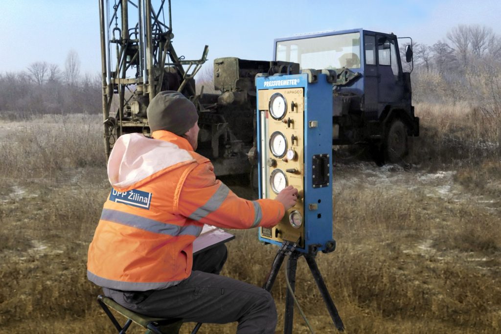
implementation and evaluation of field tests – presiometric tests, dynamic penetration tests and inclinometric measurements
determination of rock strength index under point load PLT (Point load test)
assessment of the impact of geotechnical conditions and weather conditions on the execution of excavation works
calculation and assessment of stability of slopes and notches
determinationof extractability classes according to STN 73 3050
classification of soil according to drillability for boreholes for piles
proposals for remediation measures
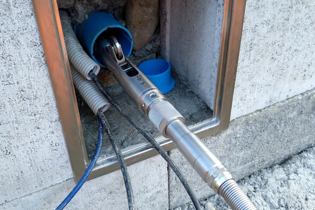
monitoring
Geotechnical monitoring:
effects of the building structure on the rock environment
monitoring of slope movement and mechanical and physical properties in the landslide zone
measurement of subsurface deformations
embankment settlement measurement
Environmental monitoring:
quality and quantity of surface and groundwater, springs and water resources
air, noise, vibrations and shocks, biota , soil (solved together with verified subcontractors)
GEOLOGICAL SUPERVISION
Geologická dokumentácia tunelov a banských diel:
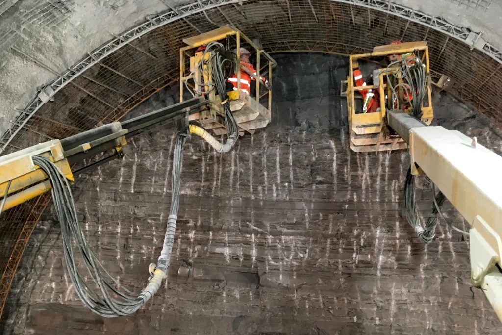
documentation of the portal wall, tunnel face and other objects in the tunnel
processing of mining and geological maps, geological-tectonic maps and longitudinal profiles of tunnels and tunnels
field measurements
Geological documentation of buildings
comprehensive geological and geotechnical supervision of realized construction pits under construction objects
documentation of physical – mechanical properties of the geological subsoil of embankments
pilot documentation
ASSESSMENTS AND CONSULTATIONS
engineering geological (IG) assessment of the evaluation of basic conditions for construction (family house, industrial buildings and others)
IG assessment of sliding faults
IG and hydrogeological assessment for landfills
IG study of the rock environment
IG study of the risks of entering the rock environment
hydrogeological assessment of the impact of construction on the quality and quantity of surface and groundwater
hydrogeological assessment for the discharge of water from a domestic wastewater treatment plant (WWTP)